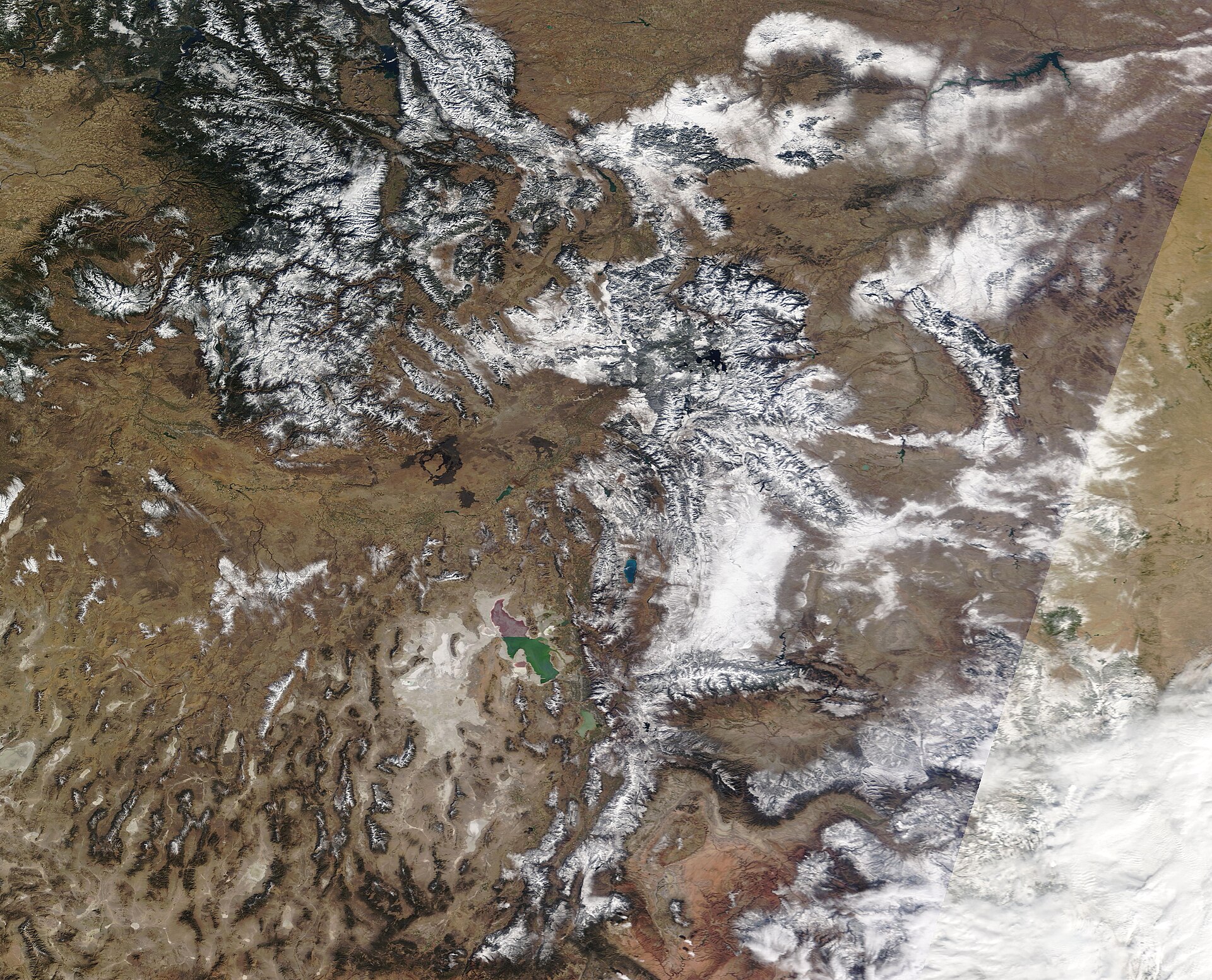
Snow is weather plus geography. Utah's geography happens to be arranged almost perfectly: Pacific storms arrive cold and relatively dry, meet a 7,000-foot wall of rock, and — a few times each winter — get an extra shove of moisture from the Great Salt Lake on the way in. Understanding those three ingredients explains nearly everything about why the Wasatch skis the way it does.
A storm's journey inland
Most Wasatch storms are born over the Pacific. Crossing California, the Sierra Nevada wrings out much of their moisture; crossing the Great Basin, they travel over hundreds of miles of high desert. What arrives in Utah is colder and drier than what hit the coast — and that, counterintuitively, is the first secret of great snow. Colder storms mean lower water content, and lower water content means lighter snow. The Wasatch sits at the sweet spot: far enough inland for cold, dry crystals, yet still close enough to the storm track to be hit regularly from October through April.
Orographic lift: the mountain squeeze
When moving air meets the Wasatch, it has nowhere to go but up — from a valley floor near 4,300 feet to crestlines above 11,000. Rising air expands and cools; cooler air holds less water vapor; the excess condenses into cloud droplets and ice crystals, and snow falls preferentially on the windward slopes and crests. Meteorologists call this orographic lift, and in the Wasatch its effect is dramatic: studies of Little Cottonwood Canyon have documented roughly a fourfold increase in precipitation between Salt Lake City and Alta, just eight miles and 4,400 vertical feet apart.
The lake that never freezes
The Great Salt Lake is the remnant of Lake Bonneville and several times saltier than the ocean — so salty that it never freezes. All winter it sits like a warm kettle in the path of cold air. When a front passes and northwest winds pour Arctic air across the 40-to-50-degree water, the lake heats and moistens the lowest layers of the atmosphere. That air becomes buoyant, convective clouds erupt, and narrow bands of heavy snow stream downwind — directly into the Salt Lake Valley and the Cottonwood canyons when the flow lines up.
University of Utah atmospheric scientist Jim Steenburgh, whose research group has studied these events for decades, estimates the lake effect contributes only about five percent of the Wasatch's annual snowfall. But the events are disproportionately memorable: post-frontal lake bands have dumped one to two feet in the valleys and more in the mountains, often as astonishingly light "blower" powder. In short, the lake doesn't make Utah's snow — it garnishes it, at exactly the moments skiers care about most.
Why the powder skis differently
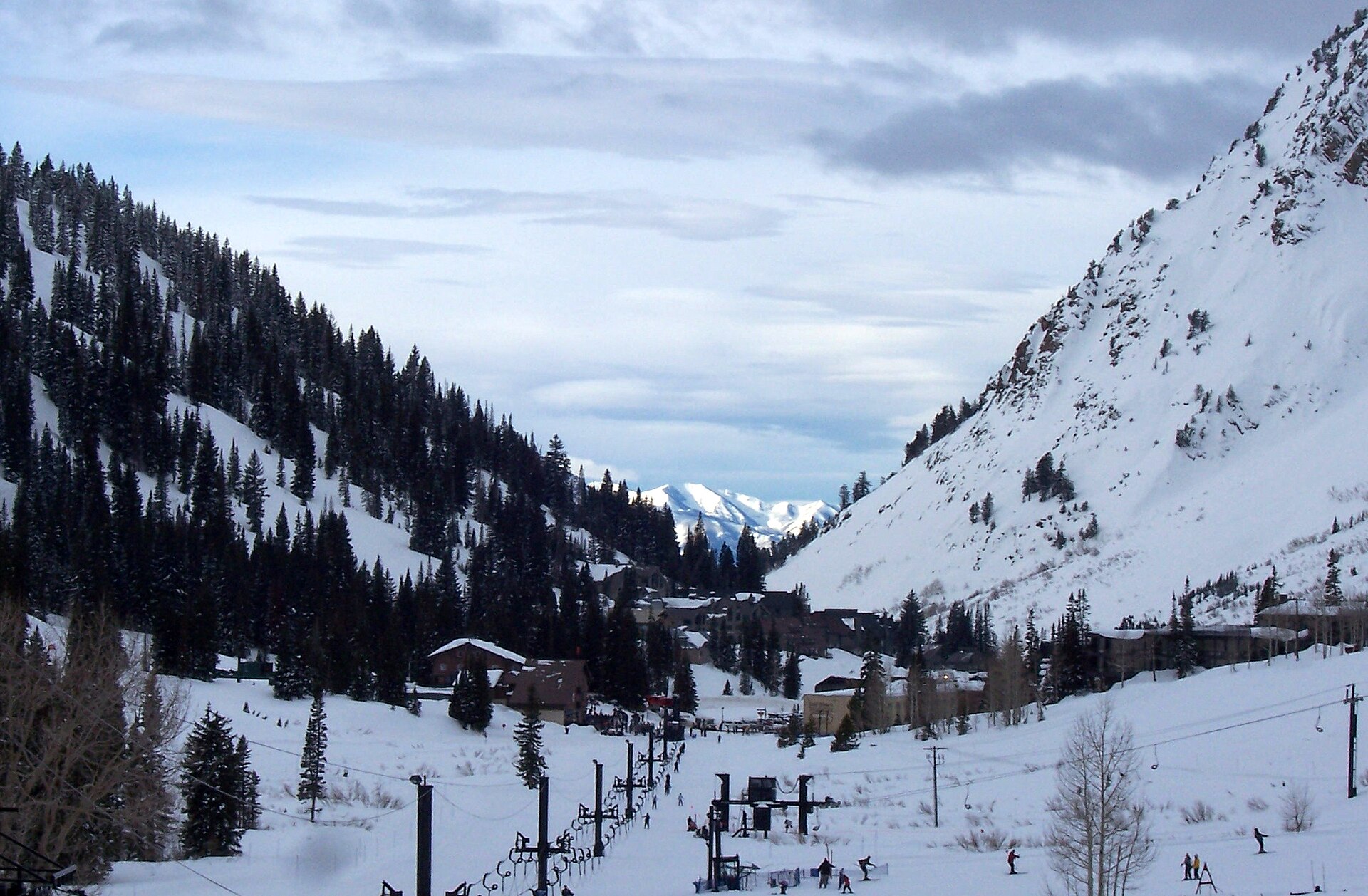
Utah license plates promise "The Greatest Snow on Earth," and the claim has real physics behind it — though not quite the physics most people assume. Alta's long-term average snow density is about 8.5 percent water content: light, but not the lightest in the world. What research at Alta has shown is that the Wasatch excels at the structure of its storms, not just their dryness.
Many Wasatch storms arrive warm and moist and finish cold and dry, laying down a denser bottom layer and progressively fluffier snow on top. Skiers call this a "right-side-up" storm: the dense base supports your skis while the light surface blows over your shoulders. Add sheer volume — 400 to 550 inches a year along the high Cottonwoods, roughly 300 inches in the Ogden-area mountains — plus cold interior temperatures that keep crystals dry between storms, and you get powder that is deep, frequent, and forgiving all at once.
- Frequency: the central Wasatch averages a snowstorm roughly every few days through midwinter.
- Density layering: warm-start, cold-finish storms create supportive, "bottomless-but-floaty" powder.
- Preservation: high elevation and dry interior air keep snow soft for days after a storm.
- Terrain match: Bonneville-carved cirques and fault-steepened bowls put that snow at ideal skiing pitches.
"The Greatest Snow on Earth"
The slogan itself has a history worthy of the snow. Salt Lake Tribune ski editor Tom Korologos coined the phrase in the early 1960s, and the Utah Travel Council adopted it in its promotions starting in 1962. The state registered it as a Utah trademark in 1975 and put it on "Ski Utah!" license plates in 1985. When Utah sought a federal trademark, Ringling Bros. and Barnum & Bailey — owners of "The Greatest Show on Earth" — objected and ultimately sued. Utah prevailed in federal court in 1997, and in 1999 the U.S. Supreme Court declined to hear the circus's appeal, leaving the state free to brag. The phrase remains a registered trademark of the State of Utah.
Respect the snowpack
The same storms that make legendary powder also build avalanche danger, and the Wasatch's continental snowpack can hide persistent weak layers for weeks. Anyone leaving a resort boundary should carry a transceiver, probe, and shovel, travel with trained partners, and read the daily forecast from the Utah Avalanche Center — one of the oldest and most respected avalanche forecasting operations in the country, with roots in the Forest Service snow-safety program founded at Alta in the 1940s.
Want to see where all this snow lands? The recreation page tours Snowbasin's Olympic terrain and the rest of the range, season by season.